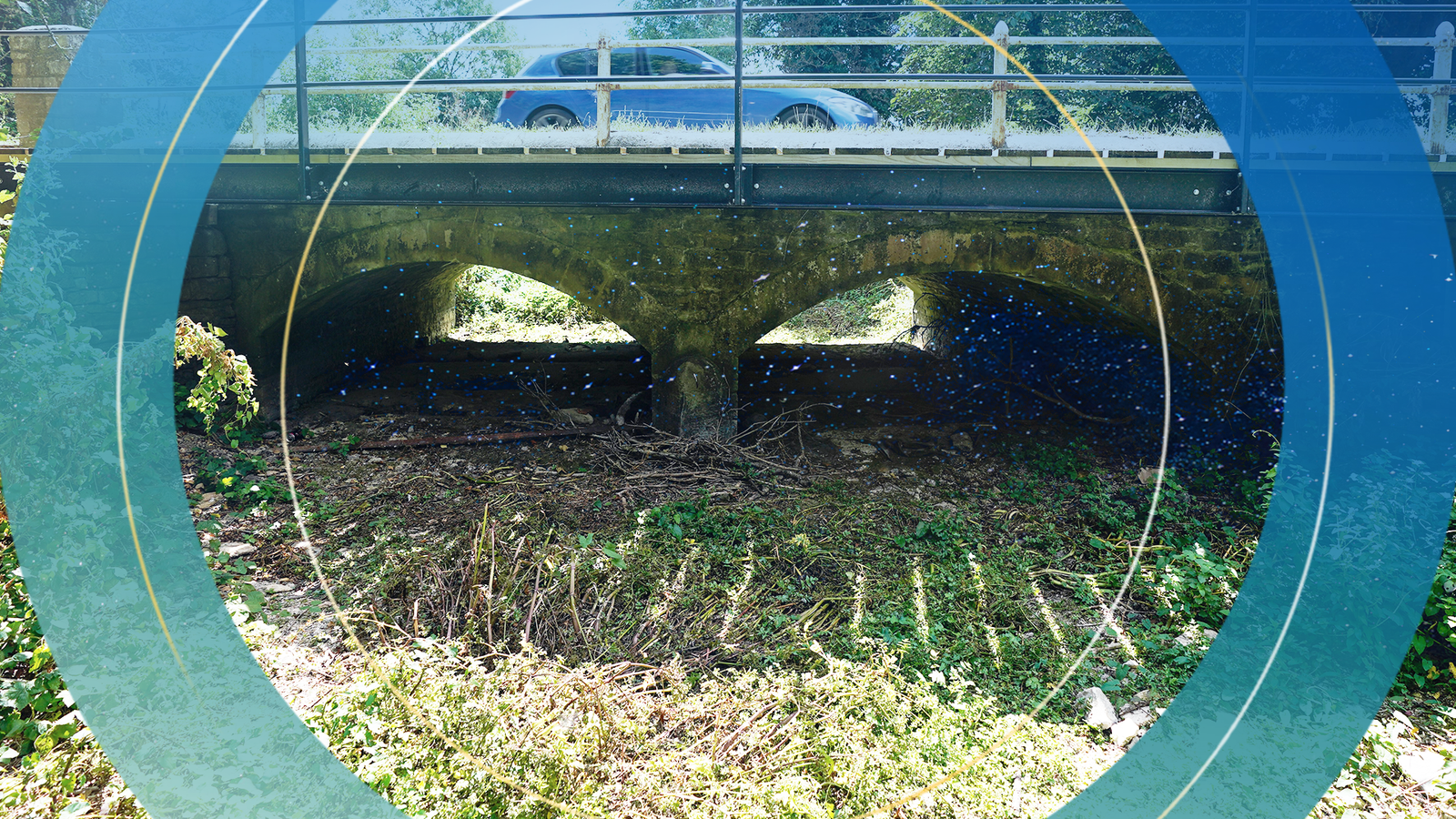
Britain’s rivers are set to run low during the coming months, and “exceptionally so” in central and southern England, compounding fears of a looming drought.
Following England’s driest July since 1935, below normal levels in waterways – a lifeline for people, plants and animals – look likely to last until November for much of the UK, a study of Britain’s water cycle has warned.
Rivers in central, southern and eastern England will be hardest hit, with rivers there expected to remain “exceptionally” low, said the UK Centre for Ecology and Hydrology (UKCEH) in a report published on Monday.
Steve Turner, a UKCEH hydrologist, told Sky News they expect “continued impacts on agriculture and the environment in addition to further pressures on water supplies, with the possibility of further restrictions”.
Already the Environment Agency has been rescuing fish from low-running rivers in Shropshire, Dorset and Derbyshire, while water companies have drawn up hosepipe bans for areas including Kent, Sussex, Hampshire and Pembrokeshire.
Most of England is currently experiencing “prolonged dry weather”, which is the earliest stage of drought, triggered when water levels in rivers, lakes, reservoirs and in the ground have been affected.
Should very dry conditions continue, parched areas would slide into the second, more serious “drought” category.
UK weather: Fire severity risk ‘exceptional’ as another heat-health alert issued
US Senate passes landmark $430bn climate change, tax and drug pricing bill to lower global warming emissions
‘Very critical situation’: Almost half of EU countries suffering from drought
UKCEH hydrologist Catherine Sefton said continued below average rainfall into a second winter would “likely result in serious hydrological and environmental drought, with further intensification of the water supply restrictions and fish rescues that we are starting to see in the South East”.
Almost all of the UK received below average rainfall in July, with the exception of the far north of Scotland. The latest weather forecast has the UK on track for hotter than normal conditions and a heatwave pushing temperatures into the mid-30s in some areas this week, triggering health alerts.
“Water levels in several major river systems are very low,” said Hannah Cloke, hydrology professor at Reading University.
“Some upper parts of rivers, including the Thames, have dried up almost completely,” she added.
Typically wetter northwest England is set to be spared such dry conditions.
Average rain is forecast for the next few months, but it will be skewed towards the wetter North West and away from the parched South East of the country.
“Due to the rainfall deficits we’ve seen over the last year, average rainfall will likely not be enough be counter the dry conditions,” Mr Turner added.
Climate breakdown is expected to bring warmer, wetter winters and hotter, drier summers to the UK overall. While drought is not set to become more frequent in the next few decades, it likely will do in the second half of this century, scientists warn.
In fewer than 30 years, some rivers could have between 50 and 80% less water during the summer months, according to the Environment Agency.
Climate change and energy correspondent
Droughts are naturally occurring events, but scientists say that climate change is making them worse.
One of the main reasons for this is that as our atmosphere heats up, it becomes much more effective at drying out the ground.
Richard Allen, professor of climate science at Reading University, puts it like this: “A warmer atmosphere is thirstier… and heatwaves further exacerbate the development of drought conditions.
“Also, because the continents are warming so rapidly, dry conditions can worsen because ocean winds cannot blow enough moisture over the land to satisfy the atmosphere’s thirst for water.”
And this isn’t the only issue.
Experts also say there is some evidence that climate change is affecting the jet stream, a current of air that circulates around the Northern hemisphere.
Although there is still significant debate over this, some theories suggest that a rapidly warming Arctic in particular is altering the jet stream’s position and shape, reducing its ability to carry rainfall systems to Europe, and increasing the likelihood that it will trap areas of high pressure in place for longer periods of time.
Of course, in some parts of the world, climate change doesn’t mean hotter and drier but hotter and wetter.
We’ve seen this in Australia and in Pakistan, India and Bangladesh recently.
Often this depends on location and season, with some places in the UK for example experiencing both drought like conditions this summer and severe rainfall and flooding earlier in the year.
Experts say this is broadly part of the same cycle that makes droughts more extreme; a warming planet and atmosphere means more evaporation which dries out the land.
This in turn leads to more moisture in the air, which results, in some parts of the world, in more extreme rainfall.
It is a complicated picture, and intense rainfall, heat and drought events are not evenly distributed across the world or even across continents and countries.
This unpredictability is yet another part of the problem, because it makes planning and adaptation more challenging.
Watch the Daily Climate Show at 3.30pm Monday to Friday, and The Climate Show with Tom Heap on Saturday and Sunday at 3.30pm and 7.30pm.
All on Sky News, on the Sky News website and app, on YouTube and Twitter.
The show investigates how global warming is changing our landscape and highlights solutions to the crisis.


