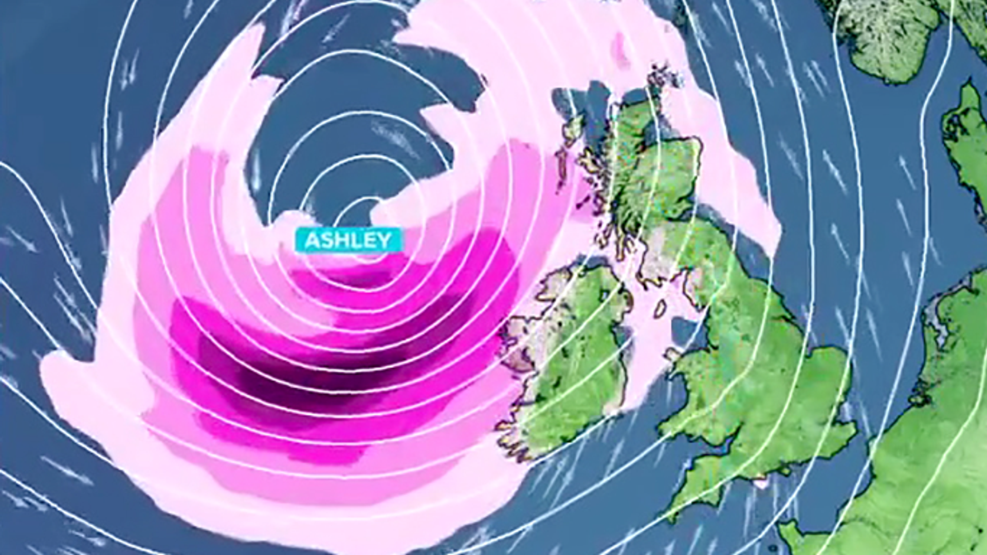
The first storm of the season has been named as wind and rain are set to hit the UK and Ireland this weekend – with an amber warning issued.
Met Eireann (the Irish Met Office) has named Storm Ashley. It comes after the UK’s Met Office previously said a low-pressure system was expected to develop “explosively” over the Atlantic.
Storm Ashley is set to bring wet weather and winds of up to 80mph, with an amber weather warning in place for parts of north and western Scotland from 9am on Sunday until midnight on the same day.
A second amber weather warning covers parts of the west coast of Ireland on Sunday as well – with all of Ireland and Northern Ireland covered in a yellow weather warning that day.
There is also a yellow weather warning in place for much of Scotland, west Wales, and the North West, from Sunday into Monday.
It comes after a fog warning covered parts of southern England on Friday morning, leaving many waking up to misty conditions.
Storm Ashley is the first named storm of the 2024/25 storm season. It comes after the US was rocked by successive hurricanes in recent weeks.
Ashley is set to develop on Friday near the coast of Canada.
There’s a lot of uncertainty about its impacts – but it will likely hit Ireland before the UK.
Due to this, it’s “likely that Sunday’s wind warning” will be updated as forecasters gather more data.
Broadcast meteorologist
Ashley, our first named storm of the season, is set to rapidly intensify this weekend, passing just to the north of Scotland later on Sunday.
So while England and Wales will experience some wet and windy weather, the worst conditions will be further north and west.
The UK and Irish met services have already issued a number of weather warnings with a risk of gales or severe gales for Ireland, Northern Ireland, Scotland, Cumbria, and western Wales on Sunday.
Western Scotland is likely to experience the worst of the storm, with an amber warning here of gusts up to 80mph in exposed areas.
The strong winds combined with high spring tides could lead to coastal overtopping.
Right now, Ashley has barely formed out in the Atlantic but it is set to rapidly deepen on Saturday night, interacting with a very strong jet stream and undergoing “explosive cyclogenesis” – this is where the central pressure drops by at least 24 millibars in 24 hours, also referred to as a “weather bomb”.
Three-day forecast
Heading into the weekend, the weather is set to remain unsettled.
Keep up with all the latest news from the UK and around the world by following Sky News
Saturday will see rain at times for many, but it’s generally set to clear to bring “a dry and fine end to the day for most”, according to the Met Office.
But by Sunday, the low-pressure system, currently approaching from the west, will bring stronger winds, especially in northern and western areas.
Read more from Sky News:
Full list of November 2024 tube strikes
National Gallery bans liquid
Wife of Tory councillor jailed over social media post
There’s potential for disruption in some places, the Met Office added.
A yellow severe weather warning is in place from 3am on Sunday until midday Monday.
Be the first to get Breaking News
Install the Sky News app for free
The strongest winds are expected Sunday afternoon and evening, with western Scotland likely in the crosshairs.
Parts of northern Wales and the North West could also be affected.


